Hi,
I’ve been made aware of the Place format editor thanks to another recent Gramps thread I don’t want to hijack here.
Actually, I don’t understand the “level” part of it, despite empirical tests from my side (on Charts view) and the following wiki description:
Levels: The place names to be displayed.
Each level in the hierarchy is represented by a positive integer, starting with 0 for the selected place and increasing by 1 for each level up the hierarchy. The levels can also be represented by negative integers, starting with -1 for the top level (usually a country) and decreasing by 1 for each level lower in the hierarchy. In addition, the populated place (city, town, village or hamlet) is represented by the letter p; this can be used with an offset (e.g. p+1 or p-2).
The names to be displayed are defined as a comma-separated list of ranges. A range can either be a single level, or a start level and an end level separated by a colon. The start level must be less than the end level in a range. The start and end levels default to 0 and -1 if missing.
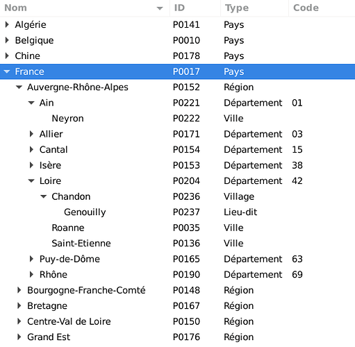
My place hierarchy is the following (the large majority of my database is France-centric):
Country > Region > French Department > City or Village > Hamlet (if need be)
Could some people take multiple examples regarding “levels” and explain them to me based on my hierarchy please?
Then I will do more tests and verify the results match the explanations on my Gramps/database.
Thanks in advance ![]()
Configuration:
- GRAMPS : 5.1.2
- Python : 3.7.3 (default, Jan 22 2021, 20:04:44)
- BSDDB : 6.2.6 (5, 3, 28)
- sqlite : 3.27.2 (2.6.0)
- LANG : fr_FR.UTF-8
- System : Linux
- Distribution : 5.10.0-0.bpo.4-amd64


